Monday, February 27, 2012

The Riverlands


We were especially keen to visit the Riverlands as this meant more time with our new best buddies Grant and Donna, who we had shared 8 caravan parks with in WA.This trip has shown us that no matter how much research we do the best way to see the sights in places we visit is to have a local guide.


The visit to Berri started promisingly as we followed the Murray River for most of the trip.  This provided us with some really good views of the great river.  When we stopped to take photos of the river en route Marty accidentally found a geocache near Swan Reach.  He just got out the car and said  “that’s an unusual pile of rocks”, lifted then up and there it was.


Then to the Wildos place at Berri. 


 A highlight was travelling with them in a tinnie up and down the Murray.  The trip included going through Lock 4 both up and down stream.  We learnt a lot about the locks and how they control the water levels and flow on the river.  Marty was fascinated as the water pumped in and out of the lock with us in it.


It was a superb day swanning up and down the great river. We also visited most of the river lands towns including Renmark, Loxton and Paringa and Marty’s favourite Winky. He kept referring to it as “Winky Dink” for reasons only he understands.


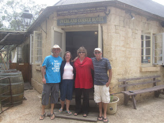
We also noshed at some nice eateries including Overland Corner, a quaint old pub in the middle of nowhere,


Tower Tavern and the Renmark Club.  We also supped wines at Berri Estates and Banrock Station.  We also got to meet many of Grant and Donna ‘s friends at a BBQ.  I thought we were very lucky but Marty thought they were as they got to meet him.


 We went to Martin’s Bend (guess why)


and the Black Stump and Headings Lookout near Paringa where we found another geocache.


Sunday, February 26, 2012

The SA South East

Back into South Australia we came, this time to the South East which time and family commitments had prevented us from exploring earlier.  However SA usually means visits to extended families and this was no exception.  We used Millicent as a base as it is the home of my Aunt Beryl and Uncle Neville and allowed us to easily visit them and their daughters and families.  We spent lots of time over old photos with Beryl and Neville and with my cousins Ally and Mon and their husbands Phil and Steve.  Both of them were kind enough to open their homes to us and provided great entertainment and meals.  In addition, Ally and Phil took the time to drive us around the area.  We saw their favourite spots at South End and Beachport and walked the beach at Robe and went to Cape Jaffa.  We also tasted a few of the wines in the area at Benson Wines and Cape Jaffa Wines.  It was nice that Aunt Beryl was able to accompany us on this trip.  We found out that Steve and Mon are very competitive geocachers.

The Beachport jetty

Bowman Scenic Drive allows visitors to explore the coastal dunes offering spectacular views of the rugged coast of the Southern Ocean

Robe

The Obelisk was erected on Cape Dombey


Natures Doorway Robe SA
But it wasn’t all family stuff.We spent a day in Mt Gambier, a “Victorian town in SA”.We commenced at the town’s water source, the Blue Lake which was spectacular.We drove right round the lake to view it from many angles and facets.We also did a guided tour which took us down to the pumping station, the only way to get close to surface level of the lake.Next was a trip up to the Centenary Tower which not only provided a good view of the lake but also highlighted the geological history of the town and surrounds.I struggled up to the tower as it rose 85m in 400m, almost a 1 in 4 gradient which is a bit too much for these old bones.As usual Marty bounced around and kept saying “the top is just around the next bend”.I am sure he said that for 4 consecutive bends.


Blue Lake – Mount Gambier water supply, located in a dormant volcano.

Blue Lake – brilliant turquoise blue water


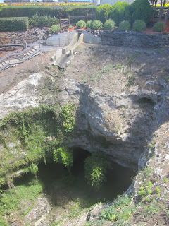
We also visited the Cave Gardens in the middle of the town. It is amazing, we were almost too scared to drive around the town in case it fell into a big hole. The Cave Gardens are a good example, as offices are built right around it. Other geological features in the town that we took in were the Umpherston Sinkhole and the Engelbrecht Cave. BTW a sinkhole is a cave without a roof.


My Dad lived at Penola for a short time, a long time ago so we decided to visit there. It was a very wet and cold day but it was nice to get a feel for where he lived as a newly married man with my brother. We also saw the historic homes in Petticoat Lane including two adjoining houses that were combined to house a family even bigger than my Dads (21 kids). In all we had a wonderful time in the area and even looked at a few houses to purchase.

The Tantanoola Tiger
during the late nineteenth century. In 1895 an animal believed to be the Tantanoola Tiger was shot and identified as an Assyrian wolf. It was stuffed and remains on display in the Tantanoola Hotel.

  Tantanoola Caves
a spectacular cave, set into a cliff face, is believed to have been exposed by the constant pounding of the ocean. Over time the sea has retreated leaving behind a cavern of interesting shells, pebbles and seal bones


Tantanoola Caves comprises an extraordinary display of cave decorations (speleothems) in beautiful shades of pink and brown, coloured by its dolomite base rock. The 'Up and Down Rocks' is a special highlight.